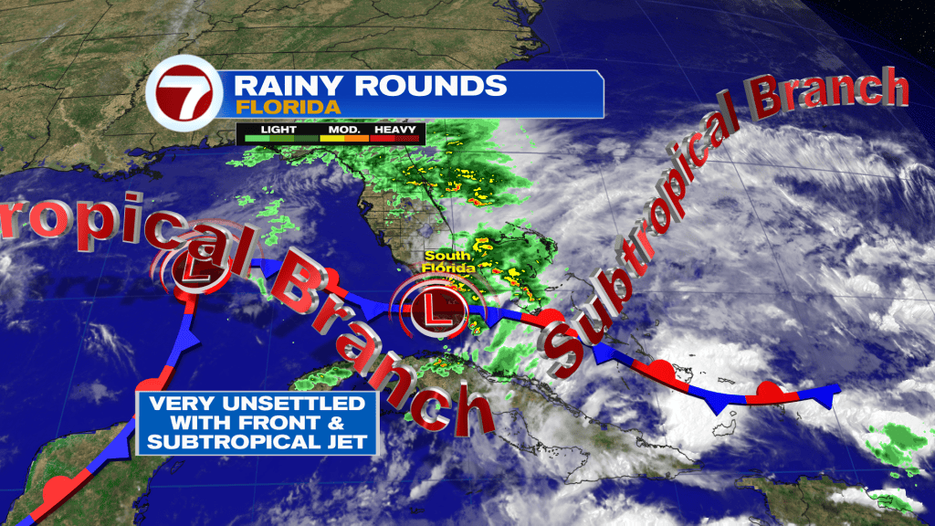
Recent rain has been relentless, south Florida. The wet weather is the result of a slow-moving Low Pressure disturbance and loads of moisture remaining over the region.
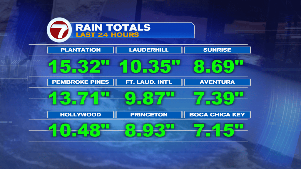
The bulk of the rain began Tuesday and seemed to peak from Tuesday night through Wednesday afternoon. As shown below, some areas (Plantation, Pembroke Pines) received over a foot of rain! Many other areas picked up between 6 and 10 inches, or more, resulting in widespread flooding.
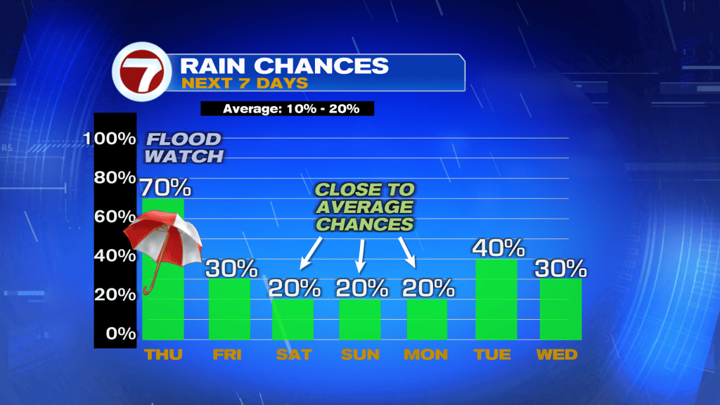
If you’re ready to start drying out, it’s likely to happen yet gradually over the next day or two.
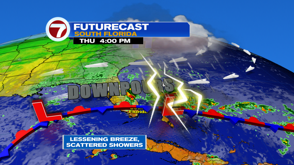
As the disturbance lifts north, along with a Front, we’ll see the “main rain” depart with it. The improvement should become more noticeable by Friday and the upcoming weekend. Until that happens, a Flood Watch is still in effect (much of Thursday).